2026 Fall Homeland | Land surveying: Often overlooked, but necessary
Sarah Hill Follow
There are a lot of misconceptions out there when it comes to land surveying. However, surveying goes far beyond glorified mapping, and is far more complex than meets the eye.
There are different types of surveys, and the survey type determines what the surveyor is looking for, but the core of surveying is mapping parcels of land.
Land surveying primarily collects data on location, northings and eastings and elevation of the land. Thirty different states use the Public Land Survey System, PLS, while the other 20 don’t have a standard system, as they were surveyed before achieving statehood. Most Western states, including Colorado, Wyoming, and neighboring states, use the PLS.
“Software collects latitude, longitude and elevation data and then we draw the survey on the computer, instead of doing it all by hand like we used to,” said Tyler Dreman, PLS, with TSD Surveying, Wellington, Colo. “Going digital has made surveying much easier. When you look at original surveys done in the late 1800s and early 1900s, some of them have neat and clean handwriting, others, not so much.”
Some ranches and farms that have been passed down through generations have very old records and no surveying has been done since the original section corners were set. Dreman said most original land surveys were done using chains pulled by mules, with the surveyor looking down a telescope and trying to line up the section boundaries.
“It’s pretty amazing how accurate they were at the time, but they could be several feet off,” he said. “If you’re a couple of feet off for a mile, that adds up to acres of land, a big discrepancy.”
Different Survey Types
When most people call me asking for a survey, the first question we ask is, ‘What type of survey do you need?'” said Dreman. “The type of survey needed depends on what project you’re doing or building or buying.”
For Dreman, some 90 percent of land surveying is done on agricultural lands, typically for real estate. Often, buyers are looking to determine boundaries or improvements through a survey of vacant ranch land, farms, dairies, etc., so they can see exactly what they’re buying. Some municipalities may require surveying for determining property lines, building site lines or design surveys for engineers working on a project. Other times, it may be that a landowner has already purchased a piece of property and wants to add on or build on the property, so they want a survey to make sure they’re within their property boundaries.
“Any time you buy a property, you should get a survey,” Dreman said. “It’s not always required, and a lot of banks and title companies only request an improvement location certificate, which is not a legally binding survey. It’s a cheap insurance policy for them that usually nix surveys, but they shouldn’t.”
Doing the survey before buying can save potential property owners thousands or even millions of dollars by detecting conservation easements, surface lease agreements for gas/oil, that fences are on the right property, and/or there’s been no encroachment by neighbors.
“A land survey is a small fraction of the purchase price to save a lot of headaches down the road,” Dreman said. “The survey helps ensure that landowners can use the property the way they want. We can find things that a realtor or potential buyer aren’t seeing or disclosed. It’s a small cost that’s worth it, and can even be included in closing costs. You don’t want to get stuck with a problem.”
Dreman has done many surveys for lawyers during boundary or encroachment disputes, and he’s seen firsthand how ugly those issues can become.
Surveying for the Future
Land surveys can also be done as part of estate planning when passing land on to the next generation. If land is being passed down to heirs so they can build on or develop that land, then the process starts with a land survey.
Dreman said he often does surveys of land where there are no heirs, so land is being sold, but there are still ways for landowners to capitalize on that land. Pieces can be split off and leased, but there needs to be a plan. For example, Dreman has helped many farm couples retire by splitting off a couple of two to five acre building sites or pivot corners from their farm. Then the couple uses that money from the sale of those small acreages to pay off the larger farm and retire.
“Land is people’s biggest asset, but most people spend the least amount of time surveying it and planning with it,” Dreman said. “You can make your land work for you besides raising livestock and row crops.”
Surveying Requirements
Each state is different in its requirements for land surveyors, but most commonly, a four year degree in surveying is needed, followed by an apprenticeship with a licensed surveyor for a set period of time, according to Dreman. Apprentice surveyors typically work as a CAD drafter, field tech or survey tech while working under a supervising professional surveyor.
Over his career, Dreman has seen an evolution in technology used for land surveying. In the past, surveyors had to be excellent at math and were looking at a level, but today’s surveyors only need to be able to use a cell phone for most surveying operations.
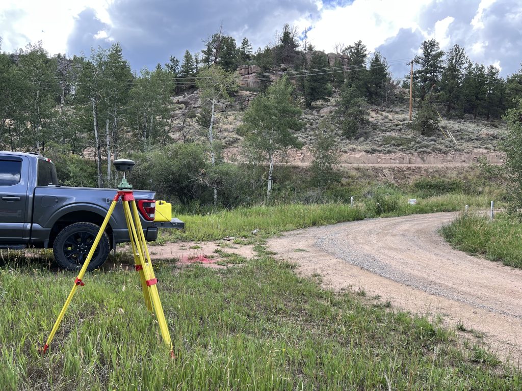
“Surveying is mostly automated, and we use robots, drones and GPS with satellites to collect data,” Dreman said. “The operator tells them where to go, and the data is within three one-hundredths, even with some human error.”