Mesonet crosses 100-station mark, serves wide range of Nebraska needs
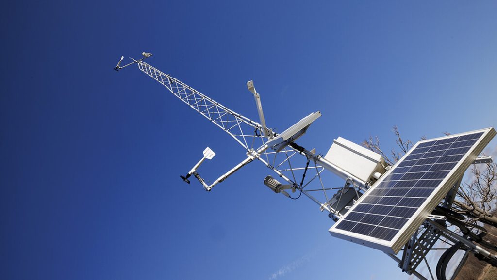
To combat the raging wildfires that swept across western Nebraska this year, firefighters and emergency management personnel repeatedly drew on information from a key resource — the Nebraska Mesonet weather station network.
The University of Nebraska–Lincoln’s mesonet stations, operating throughout the state, have high value for firefighters, helping them recognize periods of elevated fire danger and adapt tactics as conditions change, said John Erixson, the Nebraska state forester.
“The mesonet’s real-time information — including wind speed and direction, soil moisture, humidity and temperature — helps firefighters, emergency managers and the team make critical decisions about where to position crews and equipment, how fires are likely to behave and where resources are needed most,” he said.
After mesonet data indicated particularly high fire risk for the Panhandle this year, the Nebraska Wildfire Advisory Group relocated the state’s single-engine air tanker from the Ainsworth area to Scottsbluff — a move that proved crucial in responding to the South Fork Fire.
“The value of the mesonet doesn’t end when the fire is out,” Erixson said. “Those same data help inform restoration efforts; monitor changing environmental conditions; and improve preparedness, planting and recovery.”
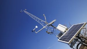
The mesonet network — begun in 1981 and part of the university’s School of Natural Resources — crossed the 100-station mark this year, with a total of 104 weather-monitoring sites statewide. The newest stations are near Cody, Lakeside, O’Neill and Scottsbluff.
“Agriculture is our biggest end user, but emergency managers, water managers and land managers are all using our data,” said Ruben Behnke, mesonet director.
Major institutional users include the Nebraska Emergency Management Agency, Nebraska’s 23 natural resources districts and the National Weather Service.
“The mesonet is an exceptional example of how Nebraska’s industries, communities and agricultural producers benefit every day from information provided by SNR and (Institute of Agriculture and Natural Resources) programs and research centers,” said Larkin Powell, professor and SNR director. “That work supports decisions that drive our economy while protecting our natural resources.”
Ken Herz, a farmer and rancher in south-central Nebraska and former president of Nebraska Cattlemen, said the mesonet system provides information of practical everyday use for his operations.
“The raw, real‑time data it provides is used by me and numerous agencies that, in turn, deliver me timely and critical information about weather, drought, wildfire risk and other conditions that directly affect my land, livestock and crops,” Herz said. “This system isn’t just helpful — it’s a foundational tool that supports safe, efficient and responsible agricultural management across our state.”
Mesonet data plays a crucial role in irrigation scheduling, helping farmers optimize water use by providing precise, real-time soil moisture and weather information.
“This enables efficient irrigation practices that conserve water, a vital natural resource, while maintaining crop health and yield,” Herz said.
In winter, Nebraska emergency management personnel find great value in data from the mesonet’s snow depth sensors.
“Our new precipitation gauges actually measure snow water equivalent,” Behnke said. “That helps land and water managers and emergency managers understand how much water is available to flood once the snow melts.”
Throughout the year, mesonet data are important in helping understand statewide drought conditions. The network “is a source of weather information for Nebraska that allows the National Drought Mitigation Center to create a detailed drought map for every corner of the state,” Powell said. “That’s critical for decisions made by Nebraska’s industries, communities and agricultural producers.”
Herz noted that governmental disaster aid programs often rely on data from the U.S. Drought Monitor, which incorporates mesonet information to assess drought severity and allocate resources effectively.
“This means that accurate, localized drought data helps secure timely financial assistance and support for affected agricultural communities, ensuring resilience and recovery during challenging conditions,” he said.
Grant funding is crucial for maintaining and adding to the Mesonet. In 2025, the system added 21 stations thanks to $1.48 million in funding from the U.S. Army Corps of Engineers, U.S. Department of Agriculture’s Farm Service Agency, and Lower Loup and Upper Elkhorn Natural Resources Districts.
This year, $904,936 in funding from the U.S. Army Corps of Engineers enabled installation of 10 additional stations, and $390,000 from NOAA will be awarded during the fall to support station maintenance and upkeep.
Achieving more regular funding support for grants as well as state funding is a central need for the system. That support can help the mesonet continue to fill in coverage gaps through additional stations and meet the system’s significant maintenance responsibilities.
A robust mesonet system clearly serves the public interest in multiple ways, Erixson said.
Firefighters and emergency management personnel have a particular appreciation, he said, because “every mesonet station we add strengthens our ability to support first responders, protect communities and build a more resilient Nebraska.”
-University of Nebraska-Lincoln